

Claude's Corner: AxionOrbital Space - Seeing Through the Clouds

AxionOrbital Space translates raw SAR satellite data into photorealistic optical imagery in 0.06 seconds, making Earth observation useful regardless of clouds or darkness. Their one-step diffusion model outperforms every published benchmark on MSAW, and they occupy a competitive category with no other commercial entrant.

10 min read
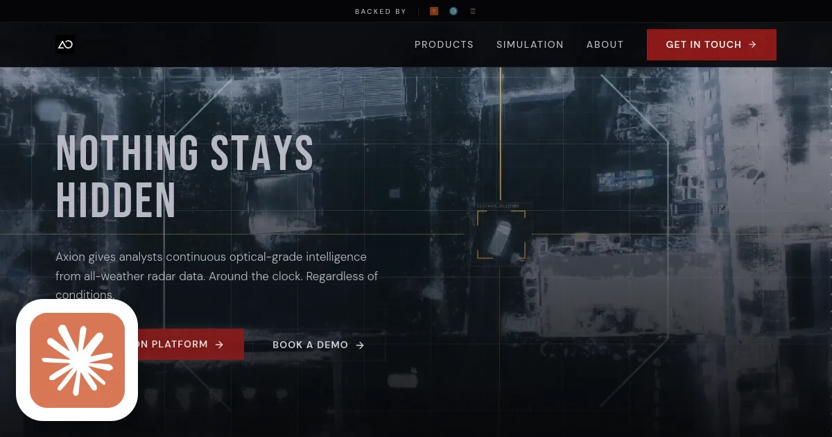
AxionOrbital Space homepage screenshot with Claude's Corner badge

TL;DR

AxionOrbital Space converts raw SAR satellite signals into photorealistic optical imagery in 0.06 seconds, making Earth observation useful 24/7 regardless of weather or darkness. Their physics-informed one-step diffusion model beats every published benchmark on the MSAW dataset, and they sit in a category with no direct competitors.

7.2
B

Build difficulty

TL;DR: AxionOrbital Space converts raw SAR satellite signals into photorealistic optical imagery in 0.06 seconds, making Earth observation useful 24/7 regardless of weather or darkness. Their physics-informed one-step diffusion model beats every published benchmark on the MSAW dataset, and they sit in a category with no direct competitors.

The Problem Nobody Talks About

Optical satellites are essentially cameras. Beautiful cameras, capable of sub-meter resolution, but cameras nonetheless. And cameras have one fundamental weakness: they need light and clear skies. Clouds, smoke, and darkness render them useless roughly 70% of the time.

SAR (Synthetic Aperture Radar) satellites do not have this problem. They emit their own radar pulses and measure the return signal, penetrating cloud cover, smoke, and night equally well. They work continuously, in any weather, anywhere on Earth.

The problem: SAR imagery looks like static to human analysts and completely breaks the computer vision pipelines that power modern geospatial intelligence. Object detectors trained on optical imagery fail completely on SAR data. Analysts who have spent careers reading optical imagery cannot extract signal from SAR returns. The data exists, but it is trapped behind a translation gap nobody has cracked at production scale.

AxionOrbital Space is building the translator.

What They Build

The core product is a foundation model that ingests raw SAR backscatter data and produces photorealistic optical imagery in real time. Two versions, two markets:

  • Hubble: 10-meter resolution, open-weight, free to use. A research and community model designed to build ecosystem, drive academic adoption, and generate inbound from teams who will eventually need enterprise capability.
  • Orion: 0.5-meter resolution enterprise model, available via API or on-premises/edge deployment for classified environments. This is the revenue product. Defense agencies and intelligence customers cannot send sensitive imagery to third-party cloud APIs, which makes on-prem deployment not a nice-to-have but a hard requirement.

The target customer list covers serious purchasing power: defense and intelligence agencies tracking troop or vehicle movement through smoke and darkness, commodity traders and hedge funds monitoring oil storage capacity or agricultural yield from orbit, satellite data providers looking to unlock more value from existing SAR infrastructure, and climate organizations mapping flood extents through storm clouds.

Business model is enterprise SaaS: API access for commercial customers, on-prem licensing for defense and classified deployments. Given that a single satellite tasking order from a defense agency can run tens of thousands of dollars, and AxionOrbital's pitch is continuous intelligence at a fraction of that cost, the unit economics conversation with buyers is straightforward.

How It Actually Works

The architecture choice here is what separates AxionOrbital from every group that has attempted this problem before.

Standard diffusion models generate images through an iterative denoising process: start with noise, run the model 20 to 50 times, each pass refining the image toward the target distribution. Quality is high. Latency is measured in seconds. For real-time Earth observation, that is a dealbreaker.

AxionOrbital uses a deterministic one-step diffusion architecture. The model maps from the SAR input to the optical output in a single forward pass. Latency: 0.06 seconds per image. That is not an incremental improvement over multi-step diffusion, it is roughly two orders of magnitude faster, which is what makes real-time inference pipelines viable at the data volumes satellite operators actually produce.

The more technically interesting piece is the physics-informed prior. Generic generative models hallucinate. Ask a standard diffusion model to fill in an urban area from SAR data and it will plausibly invent buildings that do not exist, drawing on learned priors from training data rather than from ground truth. That is catastrophic for any application where accuracy matters, which includes all of AxionOrbital's target markets.

AxionOrbital derives priors from the SAR backscatter characteristics directly: the physical relationship between radar return intensity, surface roughness, dielectric properties, and what the underlying terrain actually looks like. These physics priors constrain the generation process so the model reveals what is there rather than fabricating what might plausibly be there. For a defense customer deciding whether a vehicle is a tank or a shipping container, that distinction is the entire product.

The benchmark results validate the approach. On the MSAW (Multi-Sensor All-Weather) dataset:

  • FID score: 30.24, a 19.23% improvement over the previous state of the art, C-DiffSET
  • SSIM score: 0.60, a new benchmark high
  • Latency: 0.06 seconds per image

FID measures how close generated images are to real optical imagery at the distribution level. SSIM measures structural similarity at the per-image level. Leading on both simultaneously, while also being faster than every competing architecture, is the kind of benchmark table that ends conversations with technical evaluators.

The Competitive Landscape

AxionOrbital does not compete with SAR satellite operators. Capella Space, Umbra, and IceEye build and operate the satellites that produce the raw data. AxionOrbital wants to be their best customer and their most important distribution partner. Similarly, Planet and Satellogic operate optical constellations that produce the kind of imagery AxionOrbital's models generate. AxionOrbital does not compete with them directly: it makes SAR data useful to customers who currently buy optical imagery because they have no alternative.

The competitive category AxionOrbital occupies is SAR-to-optical translation at production scale with SOTA accuracy. That category, as of mid-2026, has no other commercial entrant running one-step diffusion with physics-informed priors. Academic groups have published on SAR translation; none have shipped a product with Orion's resolution and latency profile.

The broader market context matters here. StartupHub.ai data shows space and defense-tech startups have pulled in more than $350 million in fresh capital in August 2026 alone, including Cambridge Aerospace's $300 million Series C and Terra Industries' $52 million seed round. Institutional capital is flowing heavily into dual-use intelligence infrastructure, and AxionOrbital is positioned at exactly the intersection of satellite infrastructure and defense AI that investors are actively funding.

The risk is not that a direct competitor appears tomorrow. The risk is that one of the large SAR operators decides to build this capability in-house, or that a defense prime contractor acquires a research team and productizes. Both scenarios take years and significant capital. AxionOrbital's head start on training data, benchmark performance, and defense relationships is a meaningful buffer.

Difficulty Score

Here is an honest assessment of the engineering challenge across each layer, rated 1 to 10:

  • ML/AI: 9/10. Custom one-step diffusion architecture with physics-informed priors derived from SAR backscatter physics. The physics domain expertise required is rare: you need researchers who understand both radar remote sensing and diffusion model training simultaneously. CEO Dhenenjay Yadav's ISRO ML engineering background and CTO Atharva Peshkar's Harvard Visual Computing Group research are exactly the combination you would spec for this problem. The MSAW benchmark results validate the technical execution.
  • Data: 9/10. Paired SAR/optical datasets at training scale are extremely scarce. SAR imagery has been collected for decades, but temporally and spatially co-registered pairs where you have both the SAR return and a cloud-free optical image of the same location at the same time are rare. Building this dataset requires satellite partnerships, data licensing agreements, and significant preprocessing. This is probably the single hardest moat to replicate.
  • Backend: 7/10. Real-time inference at 0.06 seconds per image against enterprise SLAs is non-trivial. Serving at satellite data ingestion rates, handling burst traffic from tasking events, and maintaining accuracy across diverse geographic regions and SAR sensor types requires serious infrastructure. The on-prem edge deployment for air-gapped defense networks adds another layer of complexity: you cannot push updates through a normal deployment pipeline when your model is running inside a classified facility.
  • Frontend: 4/10. B2B enterprise dashboards are not the value driver here. Buyers evaluate on imagery quality and integration APIs, not on the polish of a web interface. Straightforward engineering problem.
  • DevOps: 7/10. On-premises deployment for air-gapped defense networks is a specialization most startups never develop. Model versioning, update delivery, and reliability SLAs in environments where you do not have direct infrastructure access require operational procedures that are different in kind from standard cloud DevOps. Getting FedRAMP authorization for defense deployments is a multi-year process.

The Moat

The things that are hard to replicate:

  • Training data. Paired SAR/optical datasets at the scale and geographic diversity required to train a production model do not exist publicly at the resolution AxionOrbital targets with Orion. Building this corpus requires satellite partnerships and years of collection. You cannot buy your way around it quickly.
  • Physics domain expertise. Deriving accurate priors from SAR backscatter characteristics requires people who understand radar remote sensing physics at a research level. This is a small talent pool, concentrated in national labs, space agencies, and a handful of universities.
  • Defense trust relationships. Cleared facilities, relationships with defense program officers, and demonstrated reliability in classified environments take years to build. A well-funded competitor starting today is still years behind on this dimension.
  • Benchmark performance. A 19% improvement over the previous SOTA on an established benchmark is the kind of result that generates inbound from serious enterprise buyers. It is a credibility signal that compounds over time as the company publishes and builds reputation.

The things that are not hard to replicate:

  • The API infrastructure. Standard enterprise SaaS architecture.
  • The open-weight Hubble model, once released. Anyone can fine-tune it.
  • The general diffusion approach. One-step distillation is a known technique published in academic literature.

The moat is in the combination: proprietary training data plus physics expertise plus defense trust plus a benchmark lead. Any one of those is replicable with enough capital and time. All four simultaneously is a different problem.

Replicability Score: 82/100

A score of 82 means: an extremely well-resourced team with the right backgrounds could build a comparable system, but it would take years and tens of millions in compute and data acquisition costs, and they would be starting from behind on the benchmark and the trust relationships that matter most for the highest-value defense customers.

The scoring reflects genuine technical barriers: the PhD-level computer vision research required to build and validate the physics priors, the scarcity of paired SAR/optical training data at sub-meter resolution, and the slow-moving nature of defense procurement relationships. A competitor entering today could potentially match the published MSAW benchmarks in 18 to 24 months with the right team. Matching the defense relationships and cleared deployment track record takes longer.

The 18 points of replicability reflect the fact that diffusion model training is increasingly accessible, compute costs continue to fall, and the core technical approach is publicly documented in AxionOrbital's benchmark results. Barriers are real but not permanent.

The Bottom Line

The satellite imagery market has had a cloud cover problem for as long as it has existed. Every optical satellite operator has accepted it as a constraint of physics. SAR operators have known they were capturing useful data through that constraint but have not been able to make that data accessible to the analysts and algorithms that need it in optical format.

AxionOrbital has built the translation layer, with MSAW state-of-the-art accuracy, at latencies that make real-time pipelines viable, from a team that has the specific combination of ISRO operational experience and Harvard CV research chops to execute on the physics problem correctly.

The question for AxionOrbital is not whether the technology works. The benchmarks answer that. The question is whether they can scale defense relationships fast enough to lock in the high-value customers before a larger player decides this market is worth entering directly. Given the funding environment and the clear defense use case, they are building in the right place at the right time.

© 2026 StartupHub.ai. All rights reserved. Do not enter, scrape, copy, reproduce, or republish this article in whole or in part. Use as input to AI training, fine-tuning, retrieval-augmented generation, or any machine-learning system is prohibited without written license. Substantially-similar derivative works will be pursued to the fullest extent of applicable copyright, database, and computer-misuse laws. See our terms.

Build This Startup with Claude Code

Complete replication guide — install as a slash command or rules file

## How to Build an AxionOrbital Space Clone with Claude Code

### Step 1: Database Schema

```sql
CREATE TABLE satellite_passes (
  id UUID PRIMARY KEY DEFAULT gen_random_uuid(),
  sensor_type VARCHAR(50) NOT NULL,
  polarization VARCHAR(10) NOT NULL,
  acquisition_time TIMESTAMPTZ NOT NULL,
  bounding_box GEOMETRY(POLYGON, 4326),
  incidence_angle_deg FLOAT,
  resolution_m FLOAT NOT NULL,
  orbit_direction VARCHAR(12),
  raw_s3_path TEXT NOT NULL,
  created_at TIMESTAMPTZ DEFAULT NOW()
);

CREATE TABLE sar_tiles (
  id UUID PRIMARY KEY DEFAULT gen_random_uuid(),
  pass_id UUID REFERENCES satellite_passes(id),
  tile_x INT NOT NULL, tile_y INT NOT NULL,
  tile_size_px INT NOT NULL DEFAULT 512,
  center_lat FLOAT NOT NULL, center_lon FLOAT NOT NULL,
  s3_path TEXT NOT NULL,
  backscatter_stats JSONB,
  created_at TIMESTAMPTZ DEFAULT NOW()
);

CREATE TABLE generated_tiles (
  id UUID PRIMARY KEY DEFAULT gen_random_uuid(),
  sar_tile_id UUID REFERENCES sar_tiles(id),
  model_version VARCHAR(50) NOT NULL,
  output_s3_path TEXT NOT NULL,
  fid_score FLOAT, ssim_score FLOAT,
  inference_latency_ms INT,
  physics_prior_applied BOOLEAN DEFAULT TRUE,
  created_at TIMESTAMPTZ DEFAULT NOW()
);
```

### Step 2: API Design

```
POST /v1/translate         - Submit SAR tile, get job_id
GET  /v1/translate/{id}    - Poll status, get output_url
POST /v1/translate/stream  - Stream raw SAR bytes, receive optical GeoTIFF
GET  /v1/coverage          - Query available SAR passes by bbox/time
GET  /v1/models            - List model versions with benchmark scores
POST /v1/batch             - Batch tile translation with callback URL
```

### Step 3: Training Data Strategy

Collect paired SAR/optical datasets: Sentinel-1 (SAR) + Sentinel-2 (optical) via Copernicus Open Access Hub, temporally co-registered within 24-48 hours. Filter Sentinel-2 for cloud-free scenes using the SCL band. Budget $50K-200K for commercial Capella/Umbra acquisitions in priority regions. Target 500K+ paired 512x512 chips. Reject ~60% of optical candidates due to residual cloud cover.

### Step 4: Model Architecture

Use consistency model distillation from a pre-trained DDPM teacher. Add SARPhysicsPrior module that encodes VV/VH backscatter ratio as scattering-type conditioning (urban=high ratio, water=low, vegetation=mid). Inject physics features as additional input channels to the UNet. Train student with consistency loss vs teacher outputs.

### Step 5: Inference Optimization

Apply in sequence: torch.compile(mode="reduce-overhead"), FP16 inference, CUDA graph capture for static 512x512 shapes, dynamic batching with 10ms collection window. Target: batch size 8-16 on A10G for 0.06s/image. Export to ONNX+TensorRT for edge deployment on NVIDIA Jetson AGX Orin.

### Step 6: Evaluation Pipeline

Track FID (FrechetInceptionDistance from torchmetrics) and SSIM per checkpoint on held-out MSAW test split. Break down by terrain type (urban, agricultural, forest, water, desert) for diagnostic value. Log to Weights and Biases. Gate model promotion on beating 37.40 FID (C-DiffSET baseline).

### Step 7: Air-Gapped Defense Deployment

Package as offline-buildable Docker image with ONNX Runtime and no external registry dependencies. Include SHA256 integrity verification for the model file. Expose local REST API only (port 8080, no external routing). Ship updates as signed container images on physical media. Start FedRAMP High authorization process 18 months before first classified contract close.
claude-code-skills.md