
Microdrones
Integrated drone survey equipment and software for geospatial data collection and processing.
Rate
About
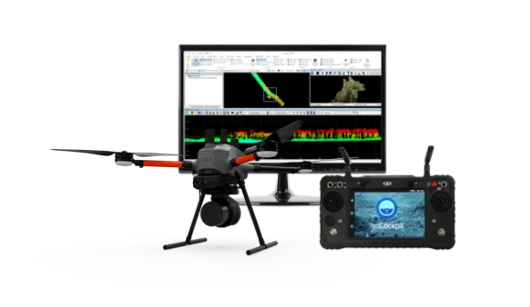
Microdrones offers integrated end-to-end drone survey equipment and software for geospatial data collection and processing. Their solutions include LiDAR and photogrammetry UAVs, along with data processing software like LP360 Drone and mdInfinity. They serve professionals in industries such as surveying, mapping, agriculture, construction, and mining.
Technology stack
detected 2026-06-23Est. monthly stack spend~$180/mo
Email Microsoft 365
Hosting
self_managed
Analytics Google Analytics 4
 Segment
 Hotjar
Comments
No comments yet. Be the first to share your take.
Frequently asked
What does Microdrones do?
Microdrones offers integrated end-to-end drone survey equipment and software for geospatial data collection and processing. Their solutions include LiDAR and photogrammetry UAVs, along with data processing software like LP360 Drone and mdInfinity. They serve professionals in industries such as surveying, mapping, agriculture, construction, and mining.
Where is Microdrones headquartered?
Microdrones is headquartered in Siegen, Germany.
When was Microdrones founded?
Microdrones was founded in 2005.
What industry does Microdrones operate in?
Microdrones operates in Drone Technology, Robotics, Computer Vision, LIDAR, Geospatial Data, Surveying.